To save paper & ink, use the [Hide] controls next to photos and comments
so you only print what you need.
Tunnel Springs
New Mexico
> Albuquerque Area
Description
This area features 35-45' tall climbs on moderate quality limestone. All routes have bolted anchors, but all require gear placement unless otherwise noted. The routes are generally sustained and the rock is sharp.
The best season for this northwest facing cliff is summer mornings(shade until ~2:00 p.m.) or spring/fall afternoons (late afternoon sun). This area provides a convenient opportunity for a half day of climbing in close proximity to Albuquerque with the opportunity for gear leads.
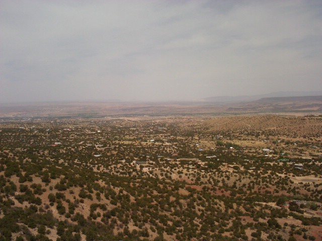
The view from the crag is beautiful. You will generally see few people, mostly a few local residents walking their dogs.
The minimum equipment for this area is a 90' gym rope, 8-10 draws, and a half rack (single set cams and nuts). Gear is generally medium to small, and sometimes tricky.
This crag is in the wilderness boundary. All bolts were hand drilled. Please observe a wilderness ethic if establishing new routes.
There is limited opportunity to safely set top ropes (the top is loaded with rocks on a steep slope and many trees have died due to bark beetle). Unless noted in the route description as safe to set a top rope - leading is recommended.
Getting There
Take the exit from I-25 and head east to Placitas. 4.8 miles from the Interstate you will see Tunnel Springs road on the right (look for the cluster of mailboxes). Turn south on Tunnel Springs road (FR 231) and drive through the development to the trailhead. (This takes ~twenty minutes from north Albuquerque.)
The approach to the cliffs is a pleasant ten minute hike along the North Crest Trail which heads east from the main parking lot. You will not see the cliff until after you round the first ridge on the trail. At about ten minutes into your hike the cliff band will come closest to the trail. Look for a cairn marking the climbers trail up to the eastern end of the wall. Hike uphill 100 yards to the routes.
[Hide Comment] You cannot see the wall from the parking lot. The trail leads E then NE around a hill and only then will the wall come into view. There is a small cairn on the right side of the main trail marking a climbers trail that switchbacks up the hill to the base of the wall. Use this trail to limit the amount of erosion and vegitation stompage.
Mar 14, 2011
[Hide Comment] All 3 of us in our party got horrible lost. Do NOT use the directions pin to get here (maps will take you to the end of the closest random road). Drive to the "Tunnel Springs Trailhead" pin.
[Hide Comment] Additional approach beta: 1) It's possible to make it to the trailhead with a 2WD, but the road has some decent potholes, heads up. 2) The trail splits pretty soon after the parking lot, stay left. 3) The north crest trail is super chill, the climbers trail is much more loose/there are occasionally sub optimal belay stances so definitely bring hiking shoes for the approach
Jun 25, 2023


 Continue with onX Maps
 Continue with Facebook


CO / NM
Chinle, AZ
7HR6+H6 Albuquerque, New Mexico
goo.gl/maps/kNuSmLSPqdU3xN2PA Feb 13, 2021
Aurora, CO
1) It's possible to make it to the trailhead with a 2WD, but the road has some decent potholes, heads up.
2) The trail splits pretty soon after the parking lot, stay left.
3) The north crest trail is super chill, the climbers trail is much more loose/there are occasionally sub optimal belay stances so definitely bring hiking shoes for the approach Jun 25, 2023