To save paper & ink, use the [Hide] controls next to photos and comments
so you only print what you need.
Rocks State Park
Maryland
Description
Rocks State Park is about 40 minutes north of Baltimore, and has some of the best trad routes in Maryland. There are three main climbing areas. The main outcropping is called the King and Queen Seat, and hosts the majority of the routes. A small, 40ft pillar juts out from the end of the King and Queen Seat, to form the Strawberry Jam Pillar. Finally, off in the woods to the east is the Smoke and Ash Crag, hosting two short routes. Most of the worthwhile climbs are in the first two areas.
There are about 25 routes and a couple of variations. A couple of them are fairly high quality for the area, and two or three are exceptional by Maryland standards. The grades range from 5.4 to 5.12 and most of the routes can be toproped, either by slinging trees and blocks, or with a bit of gear.
The rock is fairly hard and eats up stopper placements. Cam placements can be a bit tricky due to the flaring rock. The main wall, with the highest concentration of high quality routes gets early sun.
There are few objective hazards in Rocks. There are copperhead snakes in the area, and occasionally popular climbs like Breakaway(5.9) and Vertical play host to wasp nests.
There is some old fixed gear, but all new fixed gear is banned, except by permission of the park ranger. The only access issue is that the park closes at sunset, and you will be fined if you are caught in the park after dark.
Getting There
Drive north on I-95 to Route 24. Take 24 north about 10 miles. The road will go from a major highway to a small two lane country road. 24 becomes Rocks Rd. About a mile after you pass Cherry Hill Rd. You'll see a couple of parking lots on your left. If you hit a fork in the road with a bridge on the right (St. Clair's Bridge Rd.) you've gone to far. Park a the second lot and hike up the trail until you see the crag.
Alternatively, take St. Clair's Bridge Rd. to the top picnic area: the King and Queen Seat are just a few hundred meters away.
![Vertical(5.6) at Rock State Park]()
[Hide Photo] Vertical(5.6) at Rock State Park
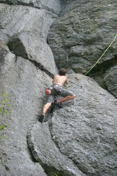
![Tanya climbs Vertical (5.6) at Breakaway Wall, Rocks State Park.]()
[Hide Photo] Tanya climbs Vertical (5.6) at Breakaway Wall, Rocks State Park.
![Digits (V2 PG13)
<br>
Real bad idea to fall off the top of this one
<br>
Trista Cuevas photo]()
[Hide Photo] Digits (V2 PG13) Real bad idea to fall off the top of this one Trista Cuevas photo
![My first lead on vertical]()
[Hide Photo] My first lead on vertical
![At the lower part of breakaway. nice corner features]()
[Hide Photo] At the lower part of breakaway. nice corner features
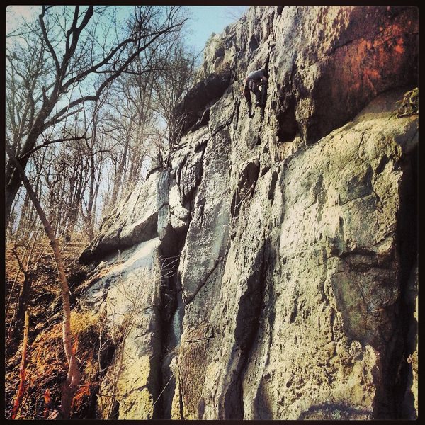
![Brakeaway Wall; the main wall at RSP. Routes vary from 5.6 (right/just out of photo) to 5.12 (center) to 5.9 (left)on this wall. Use a 60M rope when setting up on the upper belay ledge. A 3ed class exposed scramble to gain ledge. then an exposed 4 class scramble will get you up and down (not recommended); a repel down is easer and safer.]()
[Hide Photo] Brakeaway Wall; the main wall at RSP. Routes vary from 5.6 (right/just out of photo) to 5.12 (center) to 5.9 (left)on this wall. Use a 60M rope when setting up on the upper belay ledge. A 3ed class…


 Continue with onX Maps
 Continue with Facebook


parking lot low "rapids" -- (latitude longitude N39.6381 W76.4125)
. on the West side of route 24, just N of a maintenance building.
. about 1.15 mile north from the intersection with Cherry Hill Rd
. about 0.35 mile north from the intersection with Rocks Chrome Hill Rd
. about 0.25 mile south from the intersection with St Clair Bridge Rd
parking lot high "picnic" -- (N39.6351 W76.4158)
. reached by driving from St Clair Bridge Rd
Kings Queens Seat (N39.6354 W76.4129)
. West end of the cliff top ridge
Strawberry Jam Pinnacle (N39.6358 W76.4123)
. East end of the rocks
Ledge at bottom of Breakaway wall (N39.6355 W76.41235)
getting there
from Low "rapids" Parking to Kings Queens Seat
. uphill about 255 vertical feet (80 meters) over a distance of 0.2 mile (300 meters)
. typical hiking time 10-15 minutes.
. I followed the obvious well-maintained trail (with some wood steps) up South from the low Parking. Just after a radically-leaning stone pillar and a sign for a historical quarry, the main trail turned right (N39.6361 W76.4128). Here I turned Left off onto another unmarked trail and continued south up to the top of the rocks.
from High "picnic" Parking to Kings Queens Seat
. downhill about 100 vertical feet (30 meters) over a distance of 0.35 mile (600 meters)
. typical return time 5-7 minutes.
. I followed the marked wide trail at first SE then generally E.
Breakaway ledge:
In theory the wide ledge at the bottom of the Breakaway wall could be reached by scrambling up west from the route 24 road. But I found this was steep slabby dirty -- not something I'd ever do hauling gear or with ground even slightly wet. Also there's no legal parking along the road by there. Although that approach was mentioned in an old guidebook, it did not look like hardly anybody does that any more (now that there's a nice maintained trail on the N side of the rocks).
From the Kings Queens Seat, hiking down around the SW side of the rocks leads to a gully below the Breakaway ledge. Which then requires scrambling up a steep slabby dirty gully to actually reach the ledge -- not something I'd ever do hauling gear or with ground even slightly wet.
So I guess that's why most people get to the base of Breakaway by first going to Kings Queens seat, then scrambling E down the N side of the rocks, crossing the ridge a bit W of the Pinnacle and scrambling SE down the rather steep rocky gully (not something I'd try when wet). Or rappelling down in from the Epitaph Ledge. May 24, 2015
Oakland, CA
To reiterate: there are no sport routes here. The only bolts (as of Sep 2019) are atop the Strawberry Jam Pillar to enable TR anchors and rappels from the Pillar.
The rest of the routes can be TRed with anchors created from trees, slung around boulders/horns, or with trad gear. So you'll need at minimum several long slings or static rope. Sep 23, 2019
Nowhere in This Timeline