Mountain Project Logo
To save paper & ink, use the [Hide] controls next to photos and comments so you only print what you need.
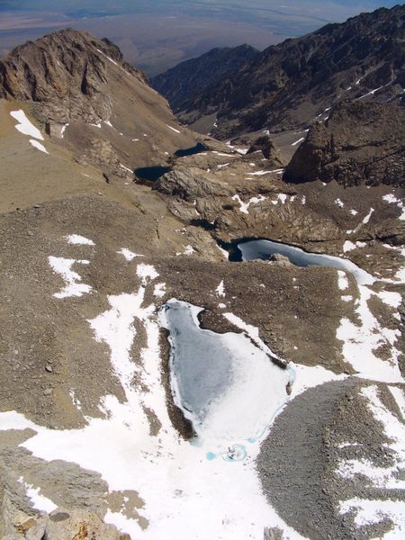
Mt. Tyndall

California > High Sierra > 13 - Shepherd Pass

Description

This beautiful peak lies to the west of Mt. Williamson.
It was first climbed on July 6, 1864 by Clarence King and Richard Cotter.
It is approached from Shepard Pass.

Getting There

Take Market Street, west from Independence. After 4.4 miles turn left on Foothill Rd. Follow a right fork. Follow signs to "Shepard Pass Trailhead".
Hike to Shepard Pass.

Routes from Left to Right

5.10 6b 20 VII- 19 E2 5b
 2
Jahloada’s Witness
Trad, Alpine 10 pitches
5.8 5b 16 VI- 15 HVS 4c
 2
Northeast Arete
Trad, Alpine
5.6 4c 14 V 12 S 4b
 3
The Tyndall Effect
Trad, Alpine 4 pitches
3rd 1- 1 I 1 M 1a
 49
North Rib
Trad, Alpine
3rd 1- 1 I 1 M 1a
 3
Atop The Northwest Ridge
Trad, Alpine
Route Name Location Star Rating Difficulty Date
Jahloada’s Witness
 2
5.10 6b 20 VII- 19 E2 5b Trad, Alpine 10 pitches
Northeast Arete
 2
5.8 5b 16 VI- 15 HVS 4c Trad, Alpine
The Tyndall Effect
 3
5.6 4c 14 V 12 S 4b Trad, Alpine 4 pitches
North Rib
 49
3rd 1- 1 I 1 M 1a Trad, Alpine
Atop The Northwest Ridge
 3
3rd 1- 1 I 1 M 1a Trad, Alpine

Photos [Hide ALL Photos]

Once we reached Sheepard Pass, we had to leave our loose herds behind...
[Hide Photo] Once we reached Sheepard Pass, we had to leave our loose herds behind...
Me looking down from one of the false summits of Mt Tyndall
[Hide Photo] Me looking down from one of the false summits of Mt Tyndall
The impressive East Face of Mt Tyndall
[Hide Photo] The impressive East Face of Mt Tyndall
Late May 2014 - even on a low snow winter, springtime options for route variations abound. The idea here was more snow, less talus.
[Hide Photo] Late May 2014 - even on a low snow winter, springtime options for route variations abound. The idea here was more snow, less talus.
Hanging out on the summit of Mt. Tyndall with Mt. Williamson in the background
[Hide Photo] Hanging out on the summit of Mt. Tyndall with Mt. Williamson in the background
Mt Tyndall as viewed from the Williamson bowl after sunrise
[Hide Photo] Mt Tyndall as viewed from the Williamson bowl after sunrise
Mt. Tyndall from the summit of Mt. Williamson
[Hide Photo] Mt. Tyndall from the summit of Mt. Williamson
Williamson Bowl from summit of Tyndall.
[Hide Photo] Williamson Bowl from summit of Tyndall.
The ridge about 150 meters from the summit.
[Hide Photo] The ridge about 150 meters from the summit.
Shepherd Pass.
[Hide Photo] Shepherd Pass.
Mt Tyndall.
[Hide Photo] Mt Tyndall.
Tyndall in the background.
[Hide Photo] Tyndall in the background.

Comments [Hide ALL Comments]

Davi Rivas
Ventura, CA
[Hide Comment] Shepherd Pass is brutal, the trail sucks but its the quickest way to Williamson Bowl and thats why Anvil Camp is nicknamed Advil Camp. Mar 2, 2010