To save paper & ink, use the [Hide] controls next to photos and comments
so you only print what you need.
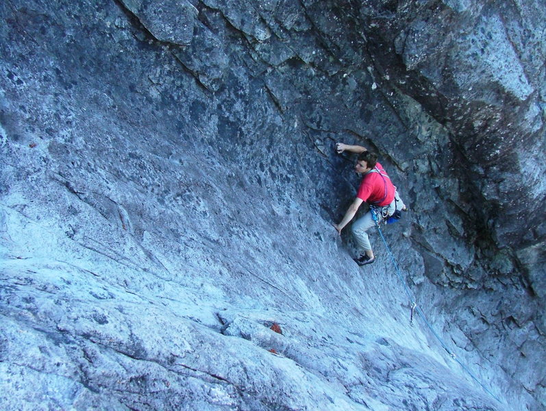
Flagstone
Oregon
> Willamette Valley
 Access Issue:
 Fire Closures, until at least Oct 26, 2023
Details
As per NF and local official orders, this is in the closure area for the Bedrock fire.
Description
Flagstone is a beautiful rock found just off a forest service backroad in the Willamette National Forest. Originally discovered in the mid 1980's, this crag remained a "locals only" crag for many years, but has since transitioned into being a popular destination within the Willamette Valley region.
The rock has three aspects facing North, West, and South. A trail skirts the entire rock and can be used as a walk-off descent from the top. The rock is andesite and of high quality. The best climbs combine friction, edges, and balance together on dark grey rock. At times the place can be secluded and other times you'll feel cramped. Since it is a small place be courteous.
Getting There
From I-5 and Eugene take highway 126 east for about 31.8 miles from beginning of highway (126 and bob straub in Thurston). Really watch the odometer and look for a sign on the right for Quartz Creek Road. Turn onto a narrow road and go over a narrow bridge. This road becomes a forest road #2618. Enjoy viewing clearcuts for the next 14.5 miles and taking a right fork at milepost 11, a left fork at milepost 13. At the junction of 2618 and 350 stay right for another 1/8th of a mile and park in a pullout on the right side of the road. The crag is up and to the left.
Although somewhat obscured from the road there is a climbers trail that leads past a message board and up to the crag (5min)


 Continue with onX Maps
 Continue with Facebook


Clinton, TN
PDX, OR
Eugene, OR
However, many of the routes are in need of re bolting. Quite a few old rusted bolts. Not an unusual thing to see on bolts approaching their third decade in stone. I would love to support the continued development of the crag as I'm sure others would. How can I help? Jun 4, 2018
Eugene, OR
The road itself is in great condition most of the way to the crag, though there's been ongoing roadwork installing new culverts. Today there was a half mile section of road leading to the 2618/1985 junction (about mile 11) that had freshly dumped and upgraded gravel, though the road was still passable in a car with low ground clearance. The holiday farm fire burn area ends at about mile 7, and there are signs for active logging around mile 10.
I noticed some lower angle routes on the north side had some hangers swiped from them, so a budding lead climber who plans to climb those may want to bring a couple nuts to use as a way to clip into the protruding bolts. Jul 4, 2021
Eugene, OR
Everyone can help us by suggesting routes that are good candidates (old bolts), and giving an accurate bolt count, if you can. Comment here, on individual route pages, or direct message Micah or me. Thanks! Jul 28, 2021