To save paper & ink, use the [Hide] controls next to photos and comments
so you only print what you need.
Northwest Pinnacles
Arizona
> Central Arizona
> *Phoenix Areas
> Superstition Mountains
 Access Issue: PLACING BOLTS IS ILLEGAL IN THE SUPERSTITION WILDERNESS!
Details
Access Issue: PLACING BOLTS IS ILLEGAL IN THE SUPERSTITION WILDERNESS!
Details
In the early '90's the USFS banned all placement of bolts in the Superstition Wilderness. This unfortunately includes replacement of existing bolts. Violating this ban may result in climbing restrictions on this beautiful area. Please think twice and go bolt somewhere else.
Description
The Northwest Pinnacles is a name for the group of spires and formations that are found off the north side of the massive western face of the Superstitions. The most well-known of these towers is The Hand, a classic Phoenix staple since first climbed in the mid 1960's by Bill Forrest.
Getting There
The Northwest Pinnacles are reached by hiking into the area from Lost Dutchman State Park. A veritable highway of a trail is followed from the Cholla Day Use Area along the Treasure Loop Trail (#56). There are various braided climber and tourist trails leading to the area of The Hand and The Tower that peel off of the Treasure Loop near where it turns right and goes south.
Here's a map (pdf format):
Lost Dutchman State Park Map (PDF)
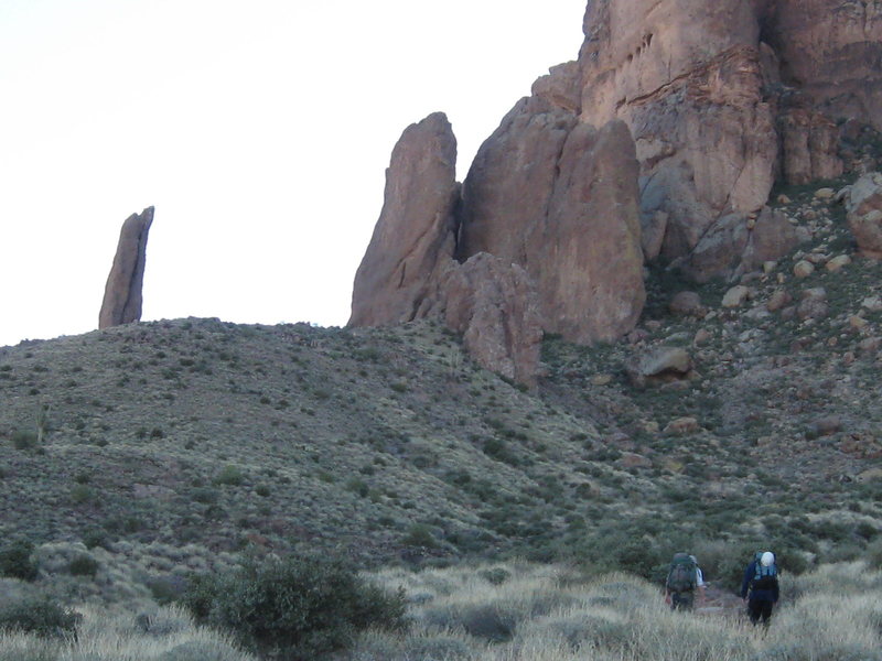
![Approaching the Hand, on the left, and the Tower, on the right.]()
[Hide Photo] Approaching the Hand, on the left, and the Tower, on the right.
![From the summit of [[111407473]], looking east at [[111619031]] and [[111631393]].]()
[Hide Photo] From the summit of The Prong, looking east at The Iceberg and Verglas Point.
![The Hand, Superstitions, AZ is creeping into the picture on the left along with various other pinnacles to the right.]()
[Hide Photo] The Hand, Superstitions, AZ is creeping into the picture on the left along with various other pinnacles to the right.


 Continue with onX Maps
 Continue with Facebook


![From the summit of [[111407473]], looking east at [[111619031]] and [[111631393]].](https://mountainproject.com/assets/photos/climb/111407587_medium_1494361514.jpg?cache=1701319219)
