Mountain Project Logo
To save paper & ink, use the [Hide] controls next to photos and comments so you only print what you need.

RMNP - Rock

Colorado > Alpine Rock
Warning Access Issue: Closures DetailsDrop down

Description

Rocky Mountain National Park (RMNP) needs little introduction as one of the most beautiful national parks in the U.S. Consequentially it has some of the most beautiful climbing in the U.S. The routes here are long, (grade III to V), committing, usually have some sections of loose rock, require a lengthy hike in, require some knowledge of snow travel, and are absolutely spectacular. In short, you need to be a competent climber to safely enjoy this area.

Climbing in the park is a complex endeavor that requires being able to analyze many different objective hazards, all while sucking air at 12-14000 feet. These hazards include loose rock, bad weather, bad pro, etc. all of which are magnified in this alpine setting. A first-time climber in the park should feel competent at leading trad at the very least a grade harder; probably two or three than the climb they wish to tackle. One should have a good deal experience on multi-pitch climbs, and one should feel in shape enough to hike five miles uphill in the dark and then climb a thousand-foot face.

All this said, the climbs are magnificent and unforgettable. Some good introductory routes would include the North Ridge of Spearhead (5.6), the Northeast Ridge on Sharkstooth (5.6), or even the East Gully on Sharkstooth (5.4 and NOT a chosspile, a really good climb). A step up from these routes would include the South Face of the Petit Grepon (5.8, with a time-consuming descent), the magnificent Culp-Bossier on Hallett (5.8+, runout 5.7). Climbing in the park really starts to open up in the 5.9 and 5.10 range. In the 5.9 range, Syke's Sickle (9+++, (7s)), the steep Hesse-Ferguson on Hallett (5.9 with low dihedral variation is in my opinion the best route on Hallett), and the Direct South Ridge of Notchtop (9) all offer spectacular and incomparable climbing.

In the 5.10 range you can't beat the Casual Route on Long's (10a), but there are other stellar 10s in the park. Chasm View Wall offers some spicy routes, and Spearhead has a couple classic 10s (The Barb and Age Axe?) with The Barb having a reputation as an "easy" 10. The Yellow Wall on the Diamond is 10c if done with the Forrest Finish variation, and is possibly the most spectacular route I have ever done. Pervertical Sanctuary (10+) is also apparently totally classic.

I have yet to venture into 5.11 and 5.12 range in the park, but two routes come to mind as totally classic, these are D7 on the Diamond (11c) and Birds of Fire on Chiefshead (11a). There are tons of other routes in the park, some suck, others are hidden gems. Exploring the more obscure routes is part of the fun of park climbing.

Getting There

Take US 36 north to Lyons. From Lyons, follow US Highway 36 to Estes Park. From Estes Park, take CO Highway 7 south to get to the Long's Peak trailhead or Wild Basin, or head directly into the park [US 36 and then left on the Bear Lake Rd.] to get to the Glacier Gorge area and the Bear Lake area.

Bypassing waiting in the lines

FWIW, if you are trying to enter during entrance fee collecting times, you can use the right lane at the Beaver Meadows entrance with the card activated gate bypassing the lines with a Rocky Mountain National Park annual pass OR a National Parks annual pass purchase at RMNP!

Annual Pass

The RMNP annual pass used to be as little as $35. As of 2019, it is now $70!

Photos [Hide ALL Photos]

Sunrise, Loch Vale
[Hide Photo] Sunrise, Loch Vale
Loch Vale in November.
[Hide Photo] Loch Vale in November.
The east to central side of upper Glacier Gorge. From left to right, Long's, Keyboard of the Winds, Pagoda, Spearhead and Chiefshead.
[Hide Photo] The east to central side of upper Glacier Gorge. From left to right, Long's, Keyboard of the Winds, Pagoda, Spearhead and Chiefshead.
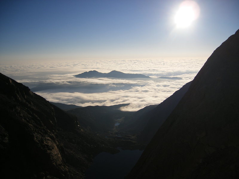
Sunrise over Chasm Lake.
[Hide Photo] Sunrise over Chasm Lake.
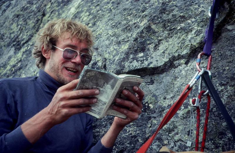
Buc Taylor looking for a clue in Fricke's Fables.<br>
<br>
Photo: Olaf Mitchell.<br>
[Hide Photo] Buc Taylor looking for a clue in Fricke's Fables. Photo: Olaf Mitchell.
The DIAMOND!!!
[Hide Photo] The DIAMOND!!!
Stellar's Jay, Rocky Mountain National Park.
<br>

<br>
www.EarthworksImagery.com.
[Hide Photo] Stellar's Jay, Rocky Mountain National Park. www.EarthworksImagery.com.
My favorite thing about being in the high country is the wildlife.<br>
<br>
That's Hallett Peak and the top of Tyndall Glacier in the background.
[Hide Photo] My favorite thing about being in the high country is the wildlife. That's Hallett Peak and the top of Tyndall Glacier in the background.
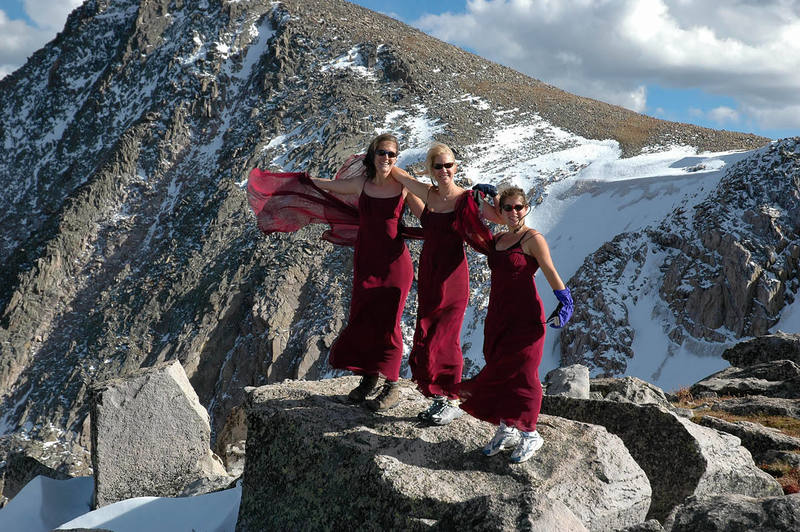
Sarah Shull hangs out on the summit of Sharkstooth. Although this is the highest summit in the park that lacks a "non-technical" ascent route, it is easily accessible by rock graded at 5.6.<br>
<br>
Photo by Tony Bubb, 1996.
[Hide Photo] Sarah Shull hangs out on the summit of Sharkstooth. Although this is the highest summit in the park that lacks a "non-technical" ascent route, it is easily accessible by rock graded at 5.…
Climber on Broadway catching an avalanche. Note the tiny spec near the middle of the pic.
[Hide Photo] Climber on Broadway catching an avalanche. Note the tiny spec near the middle of the pic.
On the way to Hallett.
[Hide Photo] On the way to Hallett.
Looking over Chasm Lake.
[Hide Photo] Looking over Chasm Lake.

Comments [Hide ALL Comments]

Julian Smith
Colorado Springs, CO
[Hide Comment] Overheard in a discussion about climbing during the winter time in Rocky Mountain National Park - "If you not being bouted at least 40% of the time, you're not trying." Dec 16, 2001
[Hide Comment] I remember reading in Dumais' ole guide to the RMNP high country how Yvon Chouinard had described the Petit as "one of the more amazing positions" he had been in. If it's okay for Yvon, it's okay for me; one of the best moderates I've ever done. Jan 8, 2002
[Hide Comment] Along with the usual dangers of Alpine climbing,(weather ,altitude ,lightning, rockfall) make sure you include marmots !! My first bad encounter was with one at Chasm Meadows 30 yrs. ago. I'd gotten a long ways ahead of my partner on the descent from the Loft so I decided to take a nap in the sun and grass using my pack as a pillow. My nap got interupted when my head hit the ground after a marmot pulled my pack out from under me! That was 30 yrs. ago and they've gotten a lot smarter in the mean time. EVERY major backcountry cliff especially Long's/Meeker, Spearhead, The Petit, and Notchtop are home to roving hordes of outlaw marmots. You might laugh but it's a real bummmer after wasting yourself on a climb to get back to your pack/bivy and find EVERYTHING eaten or torn to shreds. I string my gear up as if I was in bear country with a piece of cord thrown over any overhanging boulder to get my stuff up of the ground and out of their reach. Be carefull out there! Jan 25, 2002
[Hide Comment] Who is this mysterious Pat "Hook" Vernon you ask? And what is the location of his standard-shattering testpiece the "Pathook"? Why, that is one of the best kept secrets in RMNP and Sheffield, never to be revealed! Jan 28, 2002
[Hide Comment] The marmots are just as bad in the Chicago Basin in the San Juans beneath Sunlight, Windom, and Eolus. When I was there a few years ago in June, there was only one other guy and a marmot ate through his Bibler and thermarest while he was climbing. He didn't have a scrap of food in the tent either. On his advice, we hung everything like you would for bears, but they still got to some things. It makes you mad that you have to take down your tent and hang everything at the crack of dawn before you go out to climb... Feb 11, 2002
[Hide Comment] The area around Mummy Pass (just inside th RMNP boundary), has an abundance of unclimbed boulders, some of which will easiy go V6 or 7. The Mummy Pass trail is off Pingree road near Rustic on hwy 14. If you don't mind a long hike (7mi), and a little altitude 11,500 ft, you will find piles of quality rock. Prepare for cool nights when camping, often below 49F even in summer. Jun 26, 2002
Brad Short
Saudia Aurora, CO
[Hide Comment] Per the RMNP website: Bear Lake Road Construction

A two-year road reconstruction project on the Bear Lake Road will begin in the spring of 2003. Beginning on May 1, 2003, the road from Sprague Lake to Bear Lake will be accessible by shuttle bus only. Buses will begin running May 1st and will operate through October 31st. The shuttle bus route for this section of Bear Lake Road will run daily every 30 minutes from 5:00am to 10:00pm. The construction will recommence May 1, 2004, and will conclude, weather permitting, October 31, 2004. Again, during this time the road beyond Sprague Lake will be shuttle access only.

Winter travel from November 1, 2003, through april 30, 2004, will be allowed for private vehicles to Bear Lake. The road surface will be gravel. The Sprague Lake road will be closed during the winter of 2003 - 2004 for bridge construction.

For questions, call the park information office at 970-586-1206. Apr 18, 2003
[Hide Comment] To update Brad's comment above regarding the Bear Lake Road construction, the road will now be closed to private vehicles starting June 1, 2003 (rather than May 1, 2003). See the link below for more info:

nps.gov/romo/visit/weather/… Apr 21, 2003
[Hide Comment] Attention Long's Peak enthusiasts!!! 2 years ago, in what some call a foolish effort, but my friend, Stuart, and I call an epic rock climbing experience, we attempted the Casual Route of Long's Peak's Diamond on August 21st, 2001. Upon incliment weather we retreated on the final pitch of this impressive line. I being 15 years old at the time, and he 16, we believe we are among, if not, THE youngest combined age to attempt and nearly complete the East Face. We would appreciate anyone with information concerning the validity of our statement, or else some record should be made and massive bragging rights are rightfully ours. If you have any questions, or think we're full of it, please contact myself, Justin at __justinmig@yahoo.com__ or Stuart at __stusiff85@hotmail.com__ Apr 26, 2003
Patrick Vernon
Grand Junction, CO
[Hide Comment] Two young people did it a long time ago, maybe 1996? I cant remember they were both sixteen, ones name was Austin. Nice going, get back up there and complete it. Oh yeah Tommy caldwell did it really young too, I cant remember but I think it was something crazy like 8?

=bye Apr 28, 2003
[Hide Comment] Latest update from the Park service (as of 5/12) is construction will begin sometime in the second or third week of June. The road will stay open until then. They said the construction may start rather abruptly, so be aware the road may close quickly. Once construction begins, the road will be closed from Sprague Lake to ALL personal travel (no bikes in construction zone). The shuttle bus will run from 5am-10pm, every 30 minutes. It will run all the way to the Bear Lake parking lot, stopping at all the currently designated spots (including Glacier Gorge Junction, don't know about future plans for this lot...).

The rangers are concerned about people that miss the last bus, but will not have any other transportation after 10pm - you'll be hiking if you miss that last bus. It's ~4mi. back to the parking lot at Sprague Lk.

There's tons of snow in the Park right now; NW face of Cheifshead had ice/snow plastering the top 1/3 on Sunday. Snow coverage on the peaks is impressive. Potential for lots of ice if we get the right freeze/thaw going.

May 13, 2003
[Hide Comment] RMNP - Bouldering problem called 'Get Over It,' I heard about it through a friend but have been unable to find??? I suppose since it is a "newer" bouldering problem few have yet to hear of it, but if anyone has any information on it's whereabouts please e-mail me! Thanks! Care :) OoOooMilieuooOoO@aol.com Jun 18, 2003
[Hide Comment] What is the best guidebook to get for RMNP...The Gillet guide or the Rossiter guide? ...either High peaks or Crags...I'd love to hear comments on both.

I see the Gillet guides is "fresher" 2001 vs. 1996, but has it been updated?

Thanks Jun 23, 2003
justin dubois
Estes Park
[Hide Comment] Bernard Gillet's guide is far superior to Rossiter's.Rossiter's topos look like they were drawn by a two year old, and I find them confusing.I have never seen a more precise and clearly drawn topo as Bernard's.Only problem is, in his Lumpy book , there's all these pictures of Chris Hill. Jun 23, 2003
Scott Conner
Lyons, CO
[Hide Comment] I disagree with Justin. I find Rossiter's topos to be better than anyones. They're very detailed and usually quite accurate. Bernard's are pretty good, but more basic, with not as much detail of surrounding features. Both Guidebooks are worth owning, IMO. Bernards descriptions coupled with Rossiter's topos would make an ideal guidebook. Compare either of these to Don Reid's Yosemite guidebook and you'll realize that we've got it pretty good.

As far as High Peaks vs. Crag Areas, it depends on what areas you're more interested in. Jun 24, 2003
George Bell
Boulder, CO
[Hide Comment] For guidebooks, both are pretty darn good - it's pretty much a matter of personal preference. Check 'em both out at a bookstore and buy the one you like best (or both). I agree with Scott, Rossiter's topos are excellent while Gillett's guide has more routes and is more up-to-date. The topos in the first edition of Gillett were really poor, but he has improved them a lot in the current version (he removed the cartoons, though, this is a major minus!). The "Crags" guides I'm not so familiar with, but I believe they do not cover exactly the same areas. There are a bunch of obscure areas in the Gillett crags guide that are not in the Rossiter crag guide. They both cover Lumpy but if you want to go to any of these obscure areas this may matter to you.

The first RMNP guide I bought was by Richard DuMais. This was a very minimalist guide with no topos at all. So rejoice in the guidebook glut, either of the latest versions is a lot better than that. Jun 24, 2003
Chris Cavallaro
Lone Tree, CO
[Hide Comment] Can anyone provide me with the current conditions on the lower east face of Longs? (Kor route/ Stettners) I'm hoping to get up there soon, and wondering what mills glacier and upper kieners are like these days, and if the lower east face is still seeing much runoff.Thanks in advance! Jul 9, 2003
[Hide Comment] I was wondering where some snow was in the front range for skiing. The San Juans are getting a little thin by now. I am hoping to ski some lines this next week somewhere. If anyone has any information it would be appreciated as I haven't been North for a few months. (quality lines are a plus, but July is a tough month to be picky!)Thanks, Scott Jul 9, 2003
[Hide Comment] I'm looking for any information that anyone has on the Pfiffner Traverse, which is an 80+ mile traverse of the continental divide from Berthoud Pass to Milner Pass. Roach took 16 days to do this and I heard about someone doing it in under 24 hours. That's a big difference. Any beta would be much appreciated.

Thanks,

Dana Ernst Jul 25, 2003
[Hide Comment] Dana Ernst, The Pfiffner traverse is roughly from Longs Peak to Arapahoe Peak, but it could be longer like Gerry Roach's version. It is very hard to carry a pack on some of it. Yesterday I traversed from Longs to Pagoda and descended the West Ridge of Pagoda and headed toward Chiefshead, I only had a short piece of rope (60 feet) and used it once for a short rappel on the west ridge. The west ridge of Pagoda is the only 5th class climbing that I know of that isn't on a north ridge and it may contain the hardest climbing, although there are sections I haven't done but I don't think they are difficult. The north ridge of Paiute is also difficult and it isn't written upin Roach's books. We did a rappel there also but I think it could be avoided by stayinglower on the west side of the ridge going toward the big notch. The climbing beyond the big notch is easy enjoyable 5th class climbing. Travelling southward makes sense for the whole traverse except for the west ridge of Pagoda. Gerry Roach's books cover almost all of the terrain. Jul 25, 2003
[Hide Comment] The phone number for getting backcountry permits is(970) 586 1242. The general information number is(970) 586 1206.

Not fascinating information, but possibly useful. Jul 28, 2003
Richard Rossiter
Boulder, CO
[Hide Comment] The first guide book to RMNP was not written by Dick DuMais. Walter Fricke wrote and published A CLIMBER'S GUIDE TO THE ROCKY MOUNTAIN NATIONAL PARK AREA in 1971. The book covered features in the Estes Park valley, to include The Crags and Lumpy Ridge, as well as the High Peaks. The book contained textual descriptions as well as some excellent black and white photographs. The book was humorously nicknamed "Fricke's Follies," and has been out of print since the mid-1970s. Oct 27, 2003
[Hide Comment] Anybody have any information on [Chaos] Canyon. I hear it's totally ill, and I was looking for approach info and any other beta y'all have...

Thanks. Mar 25, 2004
[Hide Comment] Thanks to everyone that offered feedback to my question about Culp-Bossier. I appreciate it! May 6, 2004
[Hide Comment] We knew Walt Fricke's guidebook as Fricke's Fables, not Fricke's Follies.Sykes Sickle on Spearhead was named after Brit Richars Sykes. Let's not go changing the name to "psyches" Sickle.Gary Neptune May 11, 2004
[Hide Comment] Hi, My name is Grant Ortman. I was just posting to see if anyone will be climbing on Spearhead in the next few days. Today, Aug 21st, myself and a partner had to bail off The Barb because of shitty weather. I'm basically looking to see if someone is doing this route in the [coming] days if they could pluck the gear. We only had one rope so its kind of spread everywhere. Anyway [I can't] get up there until [Friday] so if someone could pluck the gear that would kick ass. I'm willing to give you one of the cams I left if anyone could contact me with the goods. So, if anyone out there plucks my gear and wants to earn karma points along with a free cam give me a call at 970-222-6469 or email me at grantortman@hotmail.com. Cheers grant Aug 21, 2005
Clint Locks
Boulder
[Hide Comment] Here's a link to the Long's Peak "web cam". 'Word on the street, however, is that it is truly a Long's Peak JPG, and infrequently updated. This is to say it's not too useful in its current incarnation/state of upkeep. Here it is, anyway:
mms.nps.gov/romo/netcam.jpg Jul 29, 2007
[Hide Comment] Perhaps it'd be helpful if this section was filed as:

All Locations > Colorado > RMNP? Sep 19, 2007
Buzz Burrell
Boulder
[Hide Comment] Pfiffner Traverse - LA Freeway. I just saw the query/post from '03. I did Long's Peak to Arapaho, all on the divide, on July 8 & 9, 2002. I named it the "LA Freeway". ("Longs" to "Arapaho", and because it's not much of a freeway; there's some stout sections in there). I did it fairly casually, 16 hrs both days, car - car. Very highly recommended. Feb 22, 2008
henrydec1
denver, colorado
[Hide Comment] I need to know where swissco is. If anyone has any info on swissco, send me something any info will help, thank you. May 10, 2008
[Hide Comment] Snow conditions in the Park? Anyone with info on the approach to the Spearhead? What about up to the Petit? Jun 13, 2009
Tony Davis
Golden, CO
[Hide Comment] If the climbers on Broadway (June 13) that were enduring the barrage of avalanches read this I have some pictures of you guys. We were on Flying Dutchman and were watching. Jun 17, 2009
Tony Davis
Golden, CO
[Hide Comment] I have to say that after the slides we heard the climbers and they seemed incredibly composed for what just happened, unlike what I would have been like! Jun 17, 2009
[Hide Comment] Does anyone have a good report for the conditions on the Diamond as of yesterday or today? Jul 15, 2009
Greg Sievers
Bozeman, MT
[Hide Comment] 9th Annual Lumpy Trails Day at Lumpy Ridge,
Rocky Mountain National Park, Estes Park, Colorado.
The Front Range Section of the American Alpine Club will be hosting a trail improvement day at Lumpy Ridge in Estes Park, Colorado. This project is in conjunction with the Access Fund ‘Adopt-A-Crag’ program. A full day is scheduled on Sunday, October 18th. Interested persons should register early by emailing event organizer Greg Sievers at g_sievers57@q.com, or calling 970-586-4075. Only those registered will receive a free lunch at the work site and T-shirt.
The group will meet at 7:30am at the Estes Park Town Hall parking lot on MacGregor Ave (downtown next to the Police Dept. and behind the library) where coffee and donuts will be provided. National park staff will supply tools and transportation to the trailhead. Volunteers should bring gloves, plenty of water, dress appropriately and are encouraged to stay for the full day (but part day help is very welcome). All volunteers in attendance at 4pm will be eligible for gifts and raffle items that are sure to please and thrill.
A good turnout will prove that ‘climbers’ are good stewards of the land and considerate users but also proactive about our interaction with one of this countries largest land management agencies. This year’s goals include work on the badly eroded “Sundance Buttress” approach trail.
In 2005 this event won the Access Fund’s “Adopt-a-Crag of the year award”. Be part of this energetic proactive event and the beauty of splitter Lumpy granite. Sep 22, 2009
[Hide Comment] I climbed the Southwest Corner with my brother a couple years back. It was my first time in the park climbing. We had a great time. Remember get there early the routes get stacked with climbers in mid am. You may not get a chance on a route if you get there after 12 noon. Sep 17, 2010
[Hide Comment] Obviously it depends on how big of a snow year it was, but how are the routes in the park around Memorial Day weekend? Trying to plan a trip and were in between sweating to death in Zion or needing crampons and axes in the park...advice? Dec 21, 2011
Charles Vernon
Colorado megalopolis
[Hide Comment] South facing routes could be good. Diamond won't be in by most people's standards. A major late spring snowstorm is always a possibility at this time too. Great climbing on nearby Lumpy Ridge if there's too much snow in the Park, though.

Sounds like you may be looking for long adventure routes...consider the Black Canyon, which is usually about perfect in late May. Possibly a tad warm, but much less so than Zion. Dec 21, 2011
[Hide Comment] Either looking for a ton of aid and walls or long, awesome, alpine free climbs...The Diamond would be on the list along with a few others, so I may need to bump our trip back a little to get us a better chance of nice weather.... Thanks, CV! Dec 22, 2011
Greg Sievers
Bozeman, MT
[Hide Comment] ALERT: for access to Spearhead, Chiefshead, Arrowhead, Loch Vale area, Sky Pond, Taylor, Petit Grepon, Cathedral Wall, Zowie, Andrews, Flattop, Otis, NotchTop, etc. etc.
BEAR LAKE ROAD reconstruction & road closures
nps.gov/romo/planyourvisit/… Apr 16, 2012
Leo Paik
Westminster, Colorado
[Hide Comment] From Kelly Cordes:

I live in Estes Park and was thinking about my weekend plans and had forgotten about the road closures up here on Saturday for the pro bicycling race. I glanced at a few links and maps, and on the NPS RMNP page it mentioned that Lumpy Ridge and RMNP access will be shut down most of the day. Climbers will probably want to know this. in looking at the map, I think that access to the Monastery will probably be closed or limited as well. Basically, all kinds of stuff around the Estes Valley seems like it'll be a mess on Saturday.

I tuned out after looking at it a little bit, and figure I'll just stay home and work Saturday anyway -- I'm buried in deadlines. So, I don't know a lot about it, but your site's viewers might find it useful.

Figured I'd email you and let you know, in case you wanted to announce it under "climbing news" or something. Or would the forum be a better place for it? I'm swamped right now and thus kinda didn't want to hassle with posting in the forums, and then dealing with questions (and accusations and insults, ha! can't imagine it, though it is a web forum, and it seems it takes about one page before the name calling begins :) ) or anything that follows -- I don't know anything more than what I quickly perused online, just figured that people would want to know about it.

If it's best for me to just post it in the forum, though, I can do that. I'll just copy-paste this.

Thoughts?

Here's some links:

stanleyhotel.com/us-pro-cyc…
nps.gov/romo/planyourvisit/…
colorado.gov/cs/Satellite?b…

cheers,
Kelly Aug 23, 2013
Patrick Vernon
Grand Junction, CO
[Hide Comment] On the west side of the park about 1.5 miles up the East Inlet trail, there are a collection of large 5-800 foot buttresses. Does anyone know if there are routes on these? They appear chossy, but the rock is granite, and the middle one looks quite steep for about 600 feet, could hold some adventure climbing. Dec 5, 2017