Gully of Higher Education Area
Utah
> Wasatch Range
> Central Wasatch
> Big Cottonwood Canyon
Description
This area includes several sectors on the three prominent north-south running ridges on the north side of the road about halfway between Storm Mountain Island and the S-Curves, about 3.2 to 3.3 odometer miles from the traffic light at the base of BCC. The three ridges, west to east, are Liberator Ridge, Lower Education Ridge, and Higher Education Ridge. Liberator Ridge and Lower Education Ridge are separated by the “Gully of Lower Education” and Lower Education Ridge and Higher Education Ridge are separated by the “Gully of Higher Education.” Over the years various first ascensionists and guidebook authors have used slightly different names for several of these features, and although I’m all for honoring original names, sorting out who named what first is ultimately a useless task and some of the original names just do not lend themselves to getting new folks to the routes. So I’ve taken the liberty to label the sectors as your read here.
The area is currently comprised of four sectors, from west to east: Liberator Ridge, Lower Education Ridge, Higher Education Ridge-West Face, and Higher Education Ridge-East Face. Other sectors may be added as the area is more fully developed (e.g., Lower Education-East Face); at least that’s the vision until Perin or one of the other administrators finds someone else to “volunteer.”
If you want to try to untangle who named what, start with pages 145-147 of the Ruckmans’ 1998 guide, pages 286-304 of Calderone’s 2017 guide (both guides are good resources in any event), and Jim Jackson’s comments on McKinley’s Slab and Lower Education (the route).
Parking
A commonly used parking area for the Gully of Higher Education and vicinity is the large pull-out easily capable of holding a dozen vehicles just east of the Higher Education Ridge. It is only parking area in which you can drive around a large pine tree. A word of warning about leaving your vehicle here: the parking area has seen a few break-ins over the last few years (my car was hit on a Friday evening in May). So if your’s is the only vehicle at the parking area during off-hours, you may want to park nearer to the road rather than at the back of the parking area and not keep valuables in the vehicle.
Before the large parking area there’s also a pull-out –- completely off pavement -- for 3 vehicles on the south side of the road directly across from the Gully of Higher Education. There are several other smaller pull-outs located on both sides of the road that may shorten the walk to the routes on Liberator Ridge and Lower Education Ridge, but chances are that part of your vehicle will have to be on pavement, which our cyclist and runner friends may not appreciate.
Sun and shade
From mid-May through mid-September, the west faces of the ridges come into the sun about 11am and go back into the shade around 5pm. Liberator Ridge tends to stay in the sun later in the afternoon than the other two ridges. If you time it right and stay in the shade, the crags can be great even in mid-summer, but they are really best during spring and fall afternoons. Some of the routes face almost south, like Tuition Hike, The Professor, and Physics of Flight on Higher Education Ridge and Lower Education on Lower Education Ridge, so they get sun sooner and hold it longer.
Getting There
The Gully of Higher Education Area is past Storm Mountain Picnic Area and before the S-Curves. Set your odometer to zero at the traffic light regulating the entrance to BCC and at 3.2 miles you should see the ridges on the left. The large parking area described above (with the drive-around pine tree) is at 3.35 miles.
The walk to get to each sector is described on the sector’s main page. Generally, Liberator Ridge is gained via steep bushwhacking, and Lower Education Ridge and the west and east faces of Higher Education Ridge have relatively good trails.
Page updated July 16, 2017.
![Higher Ed Ridge, West, lower sector: Peach-The Dweeb; purple-Party Girl; green-Frat Boy; blue-Egghead; yellow-The Professor; light blue-Tuition Hike; red-Big Man on Campus; lime-The Graduate.]()
[Hide Photo] Higher Ed Ridge, West, lower sector: Peach-The Dweeb; purple-Party Girl; green-Frat Boy; blue-Egghead; yellow-The Professor; light blue-Tuition Hike; red-Big Man on Campus; lime-The Graduate.
![Gully of Higher Education Area (taken from Standard Ridge)]()
[Hide Photo] Gully of Higher Education Area (taken from Standard Ridge)
![Ashley Tucker, Vocational Training (5.9), Higher Education Ridge, West Face.]()
[Hide Photo] Ashley Tucker, Vocational Training (5.9), Higher Education Ridge, West Face.
![Todd H on Lycra at its Limit (5.10), Higher Education Ridge, West Face. Tenesmus on belay.]()
[Hide Photo] Todd H on Lycra at its Limit (5.10), Higher Education Ridge, West Face. Tenesmus on belay.
![Eric Clark, Basic Aeronautics (5.8)]()
[Hide Photo] Eric Clark, Basic Aeronautics (5.8)
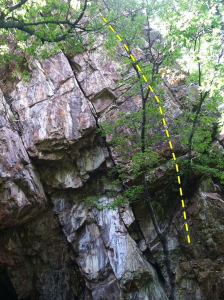
![This is the south facing "cave" area on the east side of the wall where Lycra eater(5.10 hand crack in middle)is located. Bolted route goes right up behind tree.]()
[Hide Photo] This is the south facing "cave" area on the east side of the wall where Lycra eater(5.10 hand crack in middle)is located. Bolted route goes right up behind tree.
![Lower Education Ridge (left) and Higher Education Ridge (right), from the road.]()
[Hide Photo] Lower Education Ridge (left) and Higher Education Ridge (right), from the road.
![Eric, Pop Quiz (5.11a)]()
[Hide Photo] Eric, Pop Quiz (5.11a)


 Continue with onX Maps
 Continue with Facebook


There were two good bolted routes at the top, with a nice catwalk ledge for belay.
Due to the scramble the exposure is good. Mar 4, 2006
Sandy, Utah
Yeah, that place is disappointing in terms of trash. I've cleaned it up a number of times over the years, including taking a shovel to bury someone's poop. Maybe if climbers frequented that area more often, people wouldn't be as likely to party there...
Cheers! Aug 4, 2017
Jacobstown, NJ