Mountain Project Logo
To save paper & ink, use the [Hide] controls next to photos and comments so you only print what you need.

Outer Mongolia

California > Joshua Tree NP > Wonderland of R… > Wonderland North > Middle Kingdom
Warning Access Issue: Climbing Regulations/Seasonal Raptor Closures DetailsDrop down

Description

Outer Mongolia is comprised of several large formations north of the trail that leads to the North Wonderland. The Middle Kingdom is south of Outer Mongolia.

Siberia is the largest formation and its southeast face is easily visible from the trail. There are many easy and moderate (5.8 - 5.10-) multipitch face/slab climbs that are well protected by bolts and pitons on the southeast face. These climbs are fun and the view at the top is all encompassing. Yasmine Bleeth (5.9) and Dos Chichis (5.9+) are two of the best here.

Directly north of Siberia are two east - west running gullies; the Siberian Corridor and the Khan Corridor respectively. These gullies are best accessed by scrambling over boulders in a north - south wash directly west of Siberia. Genghis Khan (5.11b) and The Mongolian Lieback (5.12a) are two stellar climbs on an overhanging north face in the Khan Corridor.

More routes for this area are described in The Wonderland Guide by Alan Bartlett.

Getting There

The approach to Outer Mongolia begins at the Boy Scout Trail to Indian Cove parking area.

Follow this trail for about two miles (take the right branch heading northeast towards the Wonderland of Rocks) until the large face of Siberia is visible from the trail. Walk north for 1/4 mile to reach the crags.

The turn off for the crag is now denoted by a trail marker that explicitly states there is a climber's trail for 'Outer Mongolia'. Took roughly 40 minutes to get to said marker hiking at a decent pace. Plan 10-30 minutes for the scramble up, depending on how oriented you already are with the area.

Photos [Hide ALL Photos]

Looking West from Outer Mongolia.<br>
Photo by Blitzo.
[Hide Photo] Looking West from Outer Mongolia. Photo by Blitzo.
Siberia
[Hide Photo] Siberia
follow the signs
[Hide Photo] follow the signs
Barrel Cacti thriving on the slopes leading to Outer Mongolia.
[Hide Photo] Barrel Cacti thriving on the slopes leading to Outer Mongolia.
Watch out for the healthy Jumping Cholla on the approach to Siberia/Outer Mongolia.
[Hide Photo] Watch out for the healthy Jumping Cholla on the approach to Siberia/Outer Mongolia.
Siberia.<br>
Photo by Blitzo.
[Hide Photo] Siberia. Photo by Blitzo.
Outer Mongolia panorama, from Land's End.<br>
Photo by Blitzo.
[Hide Photo] Outer Mongolia panorama, from Land's End. Photo by Blitzo.
Outer Mongolia-Siberia from West Mongolia.
[Hide Photo] Outer Mongolia-Siberia from West Mongolia.
The view from the trail: the large formation on the left is Siberia, while the Ivory Tower is visible as the leaning pillar just right of center.
[Hide Photo] The view from the trail: the large formation on the left is Siberia, while the Ivory Tower is visible as the leaning pillar just right of center.
Outer Mongolia from the trail. Dos Chichis (5.10a) climbs the outer face of Siberia, the large light-colored formation on the far right.
[Hide Photo] Outer Mongolia from the trail. Dos Chichis (5.10a) climbs the outer face of Siberia, the large light-colored formation on the far right.

Comments [Hide ALL Comments]

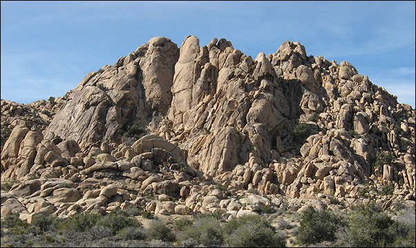
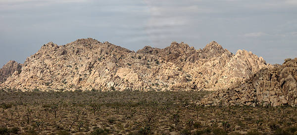
[Hide Comment] Climbed in Siberia on 3/30. Updates for "Getting There": There aren't any signs at the parking area for 'Key's Corner'; instead, it's marked as 'Boy Scout Trail'. Hike out follows the trail as described. The turn off for the crag is now denoted by a trail marker that explicitly states there is a climber's trail for 'Outer Mongolia'. Took roughly 40 minutes to get to said marker hiking at a decent pace. Plan 10-30 minutes for the scramble up, depending on how oriented you already are with the area. Apr 1, 2012