
 Continue with onX Maps
 Continue with Facebook


Pinnacle Area Climbing
| Elevation: | 180 ft |
| GPS: |
42.33152, -71.18088 Google Map · Climbing Area Map |
| Page Views: | 28,681 total · 136/month |
| Shared By: | Leo Paik on Jan 13, 2007 · Updates |
| Admins: | Old Timer, jim.dangle, Joe M |
Description

This is a collection of rock here.
We'll list these from North to South:
This is the northernmost crags within the MDC property. It is probably only 25 feet tall, and it faces west. It nearly abuts the private property and has a chain link fence on its left side.
L->R:
A. Twinkie, 6, 1p, 20', TR.
B. Yodel, 5, 1p, 20', TR.
C. Devil Dog, 6, 1p, 20', TR.
D. Oreo, 7, 1p, 20', TR.
A. Octopus, V1.
B. The Kraken, V3.
C. The Lifeboat, V0.
E. Ironsides, V1.
F. Shipwreck Traverse, V2.
G. Shipwreck Direct, V1.
H. The Captain, V2.
Moving Southeast - Eliminator Boulder (west of Eliminator Roof, Pinnacle Wall, and Pinnacle Boulder)
L->R:
A. Tree Climb, V2, 12'.
B. Pocket Cluster, V1-2, 10'.
C1. 2 Route , V1, 10'.
C2. 1 Route , V2+, 12'.
D. 3 Route, V0, 10'.
Pinnacle Wall is a small, 20-25 foot tall crag that faces southwest. It has a decent tree above for a toprope anchor. It lies in the north group of crags and is the southernmost of these crags. Long slings are useful here.
L->R:
A. Powerfool, 3-5, 1p, TR.
B. Overeasy, 4, 1p, TR.
C. Fool, 5, 1p, TR.
C2. No Fare, 4, 1p, TR.
D. Nonstop, 4, 1p, TR.
E. Inbound, 5, 1p, TR.
F. Outbound, 5, 1p, TR.
The Pinnacle Boulder and Eliminator Roof have a small set problems that are probably no more than 15 feet tall. This is a tiny area with a neat roof problem. While these are short rocks, a toprope is advisable until you have these wired, especially the Eliminator Roof.
A. West Face, 10, 1p, TR.
B. Southwest Air, 8 or V1, 20'.
C. South Face, 10, 1p, TR.
Below
A. Boulder Below Pinnacle Left, V1-2.
Eliminator Roof
A1. Side Eliminator, 8, 1p, TR.
A2. Top Eliminator, 10-.
Below:
A. Hillside Arete , V2, 15'.
From Lincoln Mahan:
Per Curtis Tripp: beware of poison ivy.
Getting There
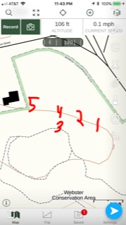
Per Lincoln Mahan: this area is North of the Green Line (of public transportation) and could be potentially called North Webster Woods. You can park in the other small lot directly off of Hammond Pond Parkway (which splits the woods in half vertically, while the Green Line runs across horizontally).
Per Zakk Day: the GPS coordinates are 42.331523, -71.180885.
FWIW, I tried to move the pin to these above coordinates, but I'm not sure there is a crag there.
Classic Climbing Routes at Pinnacle Area


Weather Averages
|
High
|
Low
|
|
Precip
|
Days w Precip
|
| J | F | M | A | M | J | J | A | S | O | N | D |
| J | F | M | A | M | J | J | A | S | O | N | D |
Photos


All Photos Within Pinnacle Area
Most Popular · Newest · RandomMore About Pinnacle Area
Printer-FriendlyWhat's New
Guidebooks (1)


0 Comments