
 Continue with onX Maps
 Continue with Facebook


Mt Si climbing info


|
|
Can anyone point me in the direction of where I can find some more information/guides about the mountain? I found several routes on summitpost for the hay stack but nothing for the vast stretch of the tall west facing walls to the north of mt si. It looks chossy but I can't believe that much exposed rock is untouched. I'm new to the northwest area and have been staying in North Bend. Mp only has info on little si and other sport climbing. I would love to do something on those formations |
|
|
From what I have heard, some parties have done routes there, but the access involved private property so the info hasn't been publicized. |
|
|
It is my understanding that the NRCA Public Use Plan limits climbing activities to existing areas where climbing has already been developed, essentially Little Mt. Si. |
|
|
You could access the cliff from public lands it just wouldn't be convenient. |
|
|
Thanks for the help! Does anyone know what has already been done on those northern wall beyond the haystack? Is there as to what you have said does that mean a no bolting rule? Or just start at little si and hike in to avoid the private land. |
|
|
Well, the Management Plan and Public Use Plan are what are listed by DNR--who manages the NRCA--as the Management Plans of record for the Mt. Si NRCA. Some people may disagree about whether these are guidelines or actual rules, but I think although the authors may not be climbers, it is pretty clear they have considered climbing as one of many uses that may impact the area socially and ecologically. That is, they have thought about more than just certain people's desire to send. The question of whether the authors are intimately involved with climbing is not relevant, as it is not a climbing document, but a Management Plan for a Natural Resource Conservation Area. The argument that they are not climbers so fuck 'em is salacious. |
|
|
I think every climber eyes that face heading east on 90. |
|
|
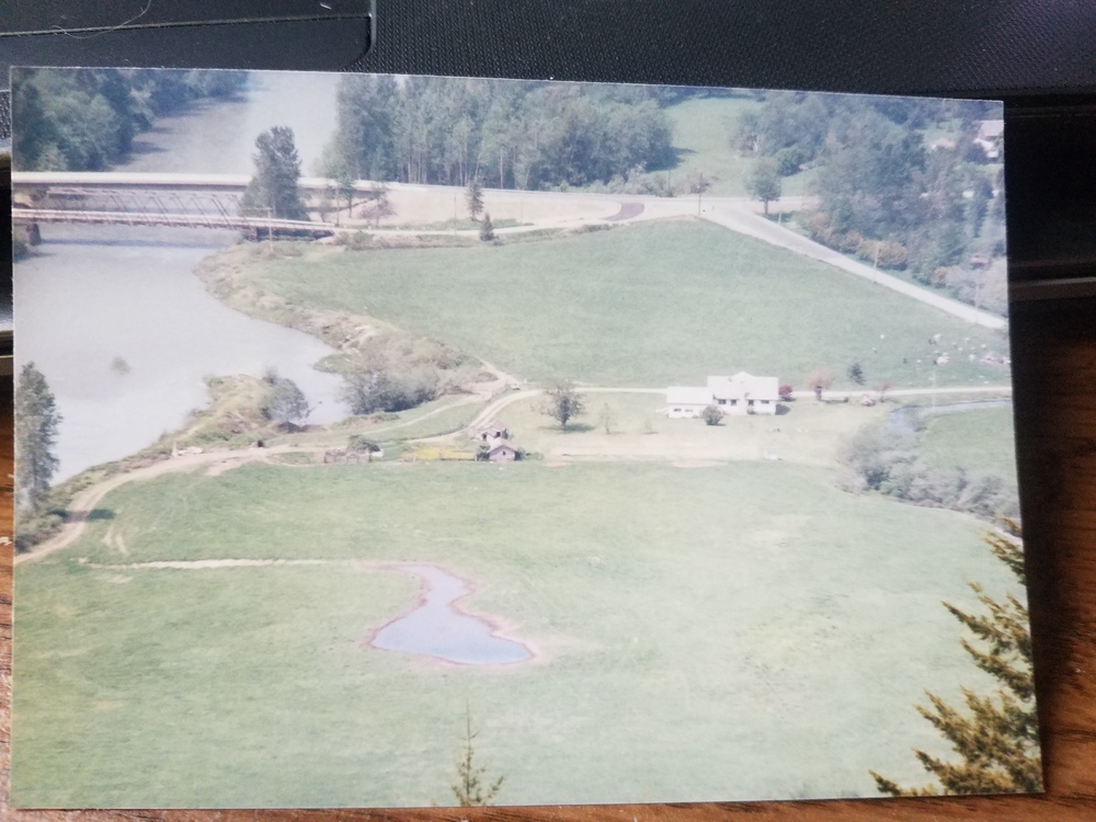
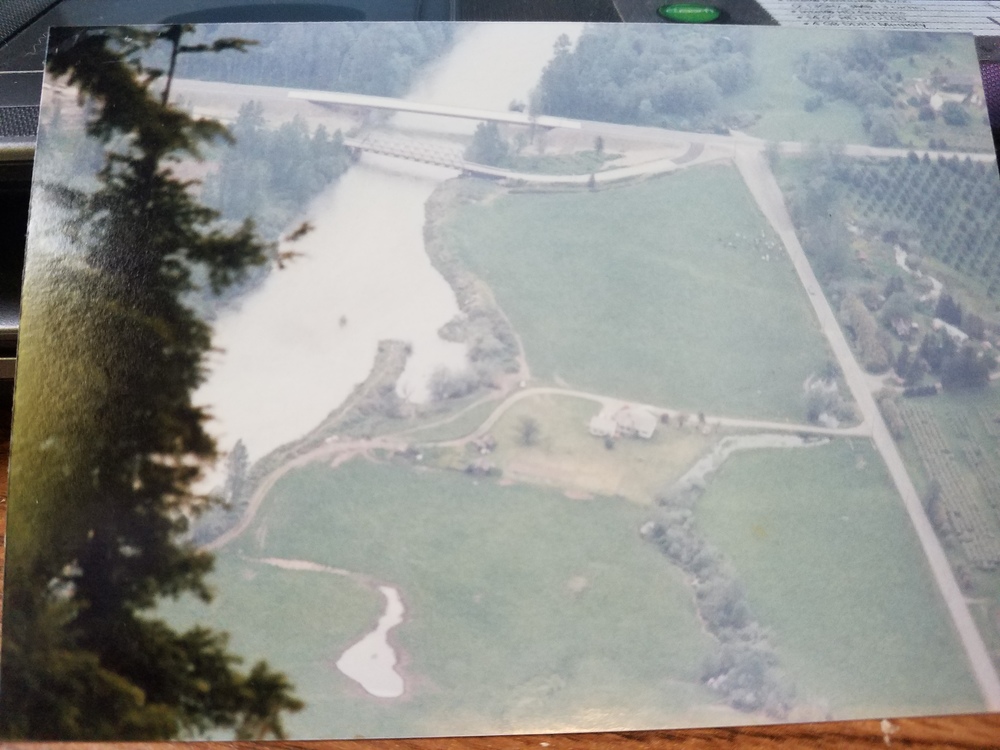
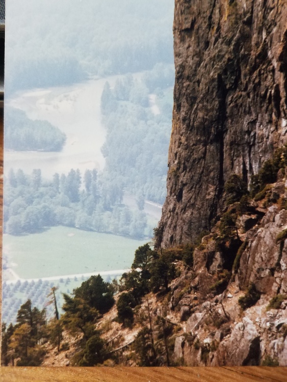
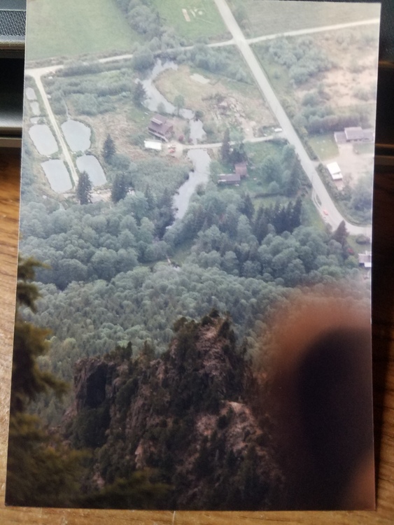
I found some old pictures a of a climb I did on the West Face about 25 years ago. Up near the top of the rock pile we hit a sheer wall but there was a small steep ledge that headed to the left (north)...very small, more like a crack with some small bushes growing out of it. My buddy Ron Briggs had been up this route once before and told me he followed mountain goat shit and figured if the goats go this way he could too. Sure enough there was fresh goat shit and even some goat hair on a bush growing out of the crack. I remember being very happy to get off that crack. We weren't using any ropes and there was lots of exposure. 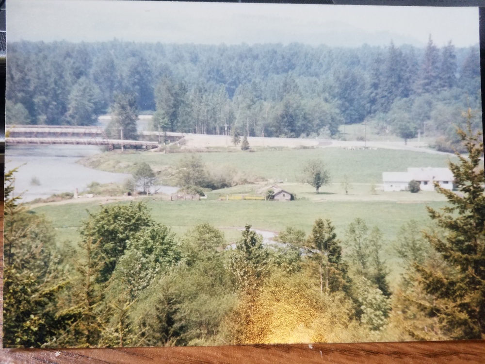 |
|
|
 |
|
|
 |
|
|
 |
|
|
 |
|
|
I climbed it last month and made this video, there's drone video that might be helpful at the end https://youtu.be/QVJb2qqR3yE |

|
i'm pretty sure this isn't the kind of climbing they were talking about.... |
|
|
Danny Done wrote: I climbed it last month and made this video, there's drone video that might be helpful at the end https://youtu.be/QVJb2qqR3yE LOL |
|
|
Chipper Maney wrote: Well, the Management Plan and Public Use Plan are what are listed by DNR--who manages the NRCA--as the Management Plans of record for the Mt. Si NRCA. Some people may disagree about whether these are guidelines or actual rules, but I think although the authors may not be climbers, it is pretty clear they have considered climbing as one of many uses that may impact the area socially and ecologically. That is, they have thought about more than just certain people's desire to send. The question of whether the authors are intimately involved with climbing is not relevant, as it is not a climbing document, but a Management Plan for a Natural Resource Conservation Area. The argument that they are not climbers so fuck 'em is salacious. Therefore, I suggest there are likely people that know what current practice is for developing or climbing outside established areas in the Mt. Si NRCA, and maybe they can chime in here. I still assert that you at least do some more research and make a firm determination about permissibility before you start climbing in these areas. For example, calling DNR would be a good start. |

|
I live in North Bend. I can see those walls from my backyard and they do look enticing. I've done a couple recon missions weaving through public land (it is possible) starting over in the Ernie's Grove area. Seeing the base of some of the walls close-up, the rock quality appears to range from decent to total choss, and any new routes would likely require a ton of cleaning after an approach that involves significant elevation gain with navigation across fields of kitty litter, scree and talus, sometimes all at once, and prone to really scary slides. In my opinion, the effort to get up there with a heavy pack of gear for route development wouldn't be worth the quality of the climbing. I have some photos on my phone that I might be able to dig up if you're really amped on the idea of exploring up there. |
|
|
Eric Rak wrote: I live in North Bend. I can see those walls from my backyard and they do look enticing. I've done a couple recon missions weaving through public land (it is possible) starting over in the Ernie's Grove area. Seeing the base of some of the walls close-up, the rock quality appears to range from decent to total choss, and any new routes would likely require a ton of cleaning after an approach that involves significant elevation gain with navigation across fields of kitty litter, scree and talus, sometimes all at once, and prone to really scary slides. In my opinion, the effort to get up there with a heavy pack of gear for route development wouldn't be worth the quality of the climbing. I have some photos on my phone that I might be able to dig up if you're really amped on the idea of exploring up there. Middle fork has a ton of potential, just whoever develops it should make sure you/they are not in the national forest (which most the road isn't, I believe just mount garfield/stuff over 2000 feet out there). |
|
|
Princess Puppy Lovr wrote: Correct, and some of it is also on Wilderness land, so further restrictions apply. |
|
|
Princess Puppy Lovr wrote: I think you mean the Alpine Lakes Wilderness. Climbing in the ALW an accepted activity. Using power drills to place permanent anchors is not. Infinite Bliss is the controversial exception to the rule. The road is not in the ALW, as roads are not allowed in wilderness areas. There's a lot to be explored outside of the ALW in new as well as established areas like Fee Demo Wall, which could use some love once the trail is re-opened. |
|
|
Eric Rak wrote: Yeah I kinda assumed you knew this but I figured if someone stumbled upon this thread and went out and started drilling that would be bad but you are correct. The ALW rules I believe are the same rules that apply to most national wilderness so that's why I made a very broad statement. By road I was more implying the hiking trails that continue off the roads that are pretty much roads. Anyway anyone who wants to develop in middle fork should read this comment by Eric and maybe talk to Joe at the access fund. Everytime I go out there I am just blown away by how much good rock there is. The boulder field that is 4 miles up snoqualmie lake trail really seems like it would be one of the best bouldering areas in washington if it wasn't guarded by a 4 mile hike with many river crossings. |


